Barry making landfall is less than 24 hours; Storm warnings provide local opportunity for ‘practice’
Published 7:21 am Friday, July 12, 2019
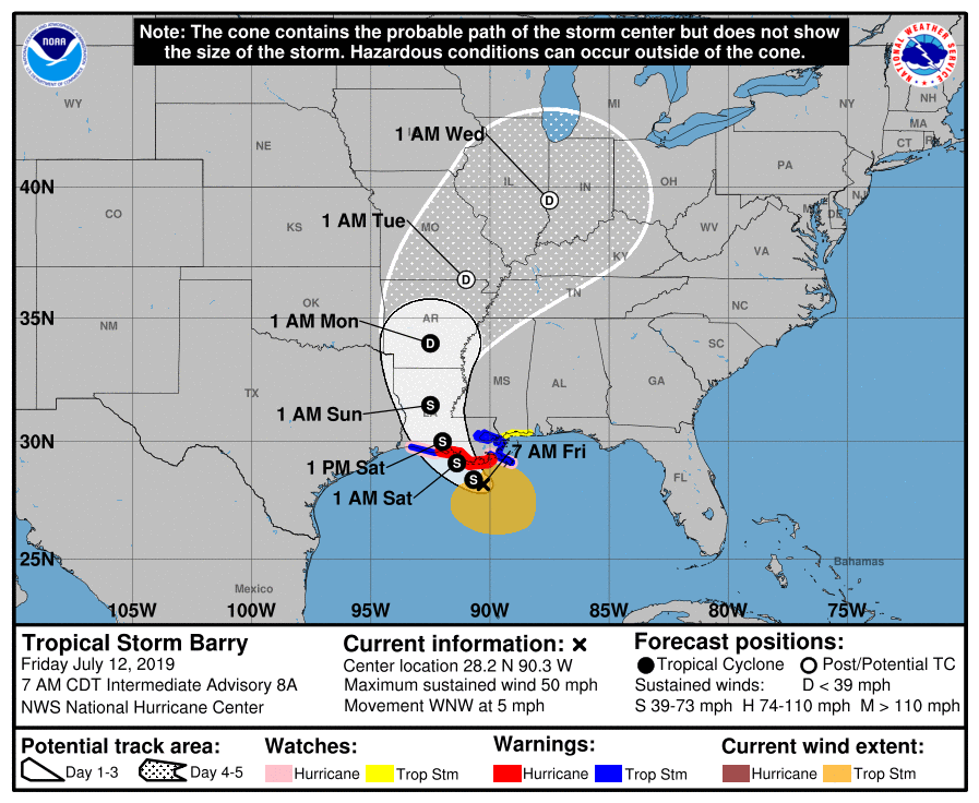
Tropical Storm Barry, which is approaching Central and Southeast Louisiana, is expected to make landfall overnight Friday into Saturday.
As of 7 a.m. Friday, Barry was 95 miles southwest of the mouth of Mississippi River and 120 miles southeast of Morgan City, the National Hurricane Center said. The storm was slowly moving west at 5 mph toward the coast of Southeast Louisiana.
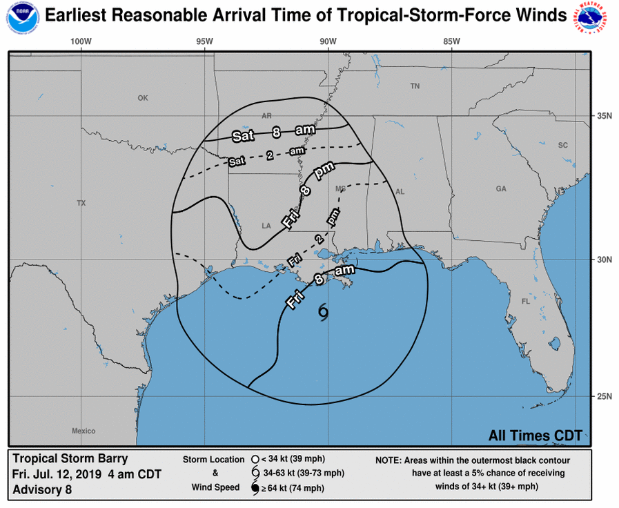
Those in Southeast Texas will start seeing increased wind and extra rain late Friday night into Saturday morning.
There is a danger of life-threatening storm surge inundation along the coast of southern and southeastern Louisiana, where a Storm Surge Warning is in effect. The highest storm surge inundation is expected between Intracoastal City and Shell Beach.
The slow movement of Barry will result in a long duration heavy rainfall and flood threat along the central Gulf Coast and inland through the lower Mississippi Valley through the weekend into early next week.
Local impact
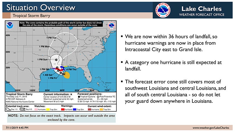
Tropical Storm Barry’s sharp turn away from Texas and toward central Louisiana should spare Port Arthur significant heartache this weekend.
“On the forecast track, the center of Barry will be near or over the central or southeastern coast of Louisiana Friday night or Saturday, and then move inland into the lower Mississippi Valley on Sunday,” the National Weather Service said.
“We are safe,” said Cheryl Gibbs, spokeswoman for the city of Port Arthur. “They are calling us safe right now.”
That doesn’t mean the storm system’s effects will necessarily bypass the Texas Coast altogether.
“They are thinking rain and possibly some gusty winds,” she said.
In Nederland, City Manager Chris Duque said he and other city officials were awaiting late afternoon and evening forecasts and advisories.
“(Thursday) morning, there was a strong feeling for the track being east of where they were initially anticipating,” he said. “But you never know what these storms are going to do. You can go from sunshine to dealing with a problem very soon.”
Area industries
Motiva Enterprises said in an issued statement, “Motiva is closely monitoring the potential storm developing in the gulf and is following the company’s Hurricane Action Plan in preparation for possible impacts to the Port Arthur Refinery.
“Motiva will take all necessary precautions to ensure the safety of people and property and to protect the environment.”
At Sabine Pass, Golden Pass LNG plant construction continued Thursday afternoon with some 100 to 200 employees and contract workers on duty.
Robert J. Bilnoski, vice president of human resources and public affairs, said the company, which hasn’t recorded a work-related accident in eight years, was following an emergency plan that starts 180 hours out and continues.
“We do small things, like tie down loose things,” he said. “Right now, we’re still moving. We definitely have rain, but we are following our response plan.”
He said the company is still in the site preparation stage — “We’re moving dirt,” he said — and engineers and contractors were working.
“If it shuts us down a day or two, fine. We’ll come back. But that call hasn’t come yet.”
Response
Kacee Kirschvink, spokeswoman for Entergy Texas, said some 200 workers from the Conroe and Huntsville area would move into the Beaumont-Port Arthur area on Friday and deploy where needed — even to Louisiana, if necessary.
“Entergy Louisiana is another operating company but we will be ready to respond,” she said.
At United Way of Mid and South County, CEO Janie Johnson said the agency had reviewed its own emergency plan but by Thursday, the need appeared to have passed.
She said the United Way is restricted when sending help beyond its territory, although in emergencies it can help other United Way organizations. No one in her office has forgotten the help others in the United Way network sent to her office during Hurricane and Tropical Storm Harvey.
“We might reach out to our neighbors in Louisiana,”Johnson said, if needed and permitted.
Duque said for Nederland, this week’s events provided a good practice run.
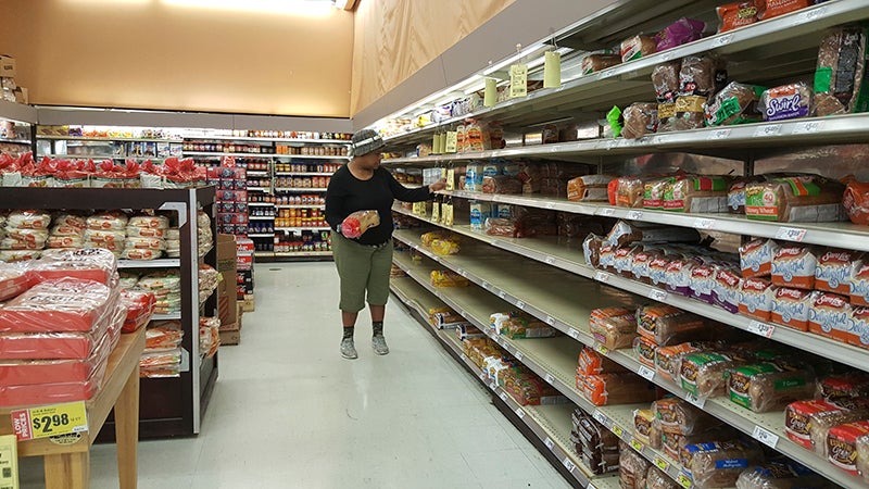
He said his family had purchased water and other supplies in case of emergency here, and they will be placed in storage for the next possible storm.
“It’s only July 11,” he said; the hurricane season ends Nov. 30. “We’ve got a long way to go.”
Barry is expected to produce total rain accumulations of 10 to 20 inches over southeast Louisiana and southwest Mississippi, with isolated maximum amounts of 25 inches.
These rains are expected to lead to dangerous, life-threatening flooding over portions of the central Gulf Coast into the Lower Mississippi Valley.


