Wednesday morning update: Tropical depression development likely before Texas impact
Published 12:02 am Wednesday, July 22, 2020
|
Getting your Trinity Audio player ready...
|
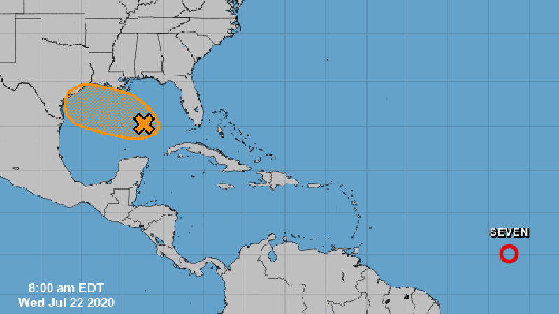
The National Hurricane Center increased the chance for tropical development to 50 percent for a tropical wave approaching the central Gulf of Mexico.
The National Weather Service said this system could become a tropical depression this week as it heads towards Texas.
Warning Coordination Meteorologist Roger Erickson said the primary weather hazards are increased rain chances and elevated tides.
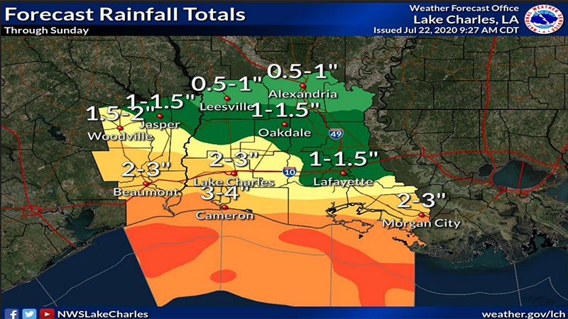
National Weather Service Meteorologist Rob Megnia told Port Arthur Newsmedia Wednesday morning he is reluctant to forecast a storm landfall time because it is still just a mass of disorganized moisture. He said Southeast Texas and Southwest Louisiana are going to see increased rain over the next five days.
According to Megnia, total rainfall could reach five inches over that time, with locally higher totals possible.
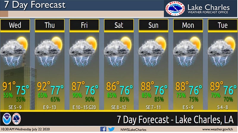
This wave will likely bring widespread showers and thunderstorms to the area Thursday through the weekend.
Elsewhere, tropical depression seven out in the Atlantic Ocean will likely become Tropical Storm Gonzalo on Wednesday.
This system poses no threat to the Gulf this week, but will need to be monitored into next week.


