National Weather Service details severe weather threat for Tuesday that may include flooding
Published 7:50 am Sunday, January 22, 2023
|
Getting your Trinity Audio player ready...
|
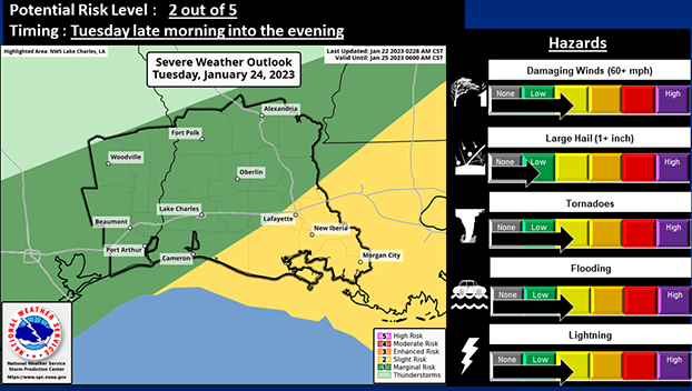
According to the National Weather Service, there is the potential for severe weather and flooding on Tuesday.
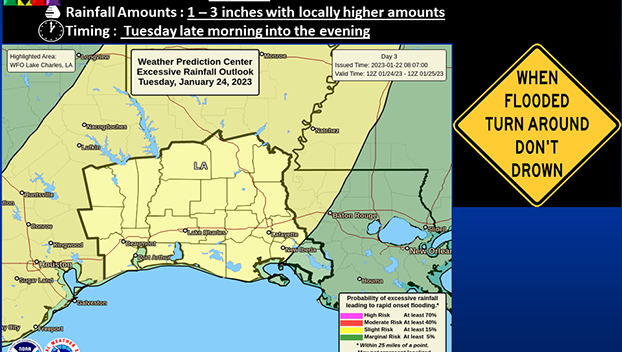
A Slight Risk (2 out of 4) for excessive rainfall is in place for most of the forecast area.
Expect most locations to receive between an inch and three inches of rainfall, with locally higher amounts possible.
These heavier rains could produce localized flooding.
Damaging wind gusts look to be the primary threat with these storms, although there is a chance for the development of tornadoes as well. Frequent cloud to ground lightning will also be possible.
Showers and scattered thunderstorms will begin to develop around sunrise Tuesday morning in Southeast Texas, then spread eastward across the rest of the forecast area into the afternoon.
The convection will eventually move out of the area beginning late Tuesday evening.
The National Weather Service says confidence is moderate for the excessive rainfall threat. However, confidence in the severe weather threat is less at this time due to questions of how much instability will be available to fuel storm development.


