Hurricane Update
Published 8:19 am Friday, August 25, 2017
Through the course of the hurricane and the resulting storms, we will be posting new and incoming information here. Please check with us for all you need to know.
2:10 p.m. Aug. 26
Trending
From the National Weather Service:
2:00 p.m. Aug. 26
Data from weather stations around the globe. Click on an specific area to see wind speeds for Harvey.
1:40 p.m. Aug. 26
Jefferson County will continue to be under a Tornado Watch until 2:00 a.m. Sunday morning.
Trending
1:25 p.m. Aug. 26
From the Louisiana Hurricane Center
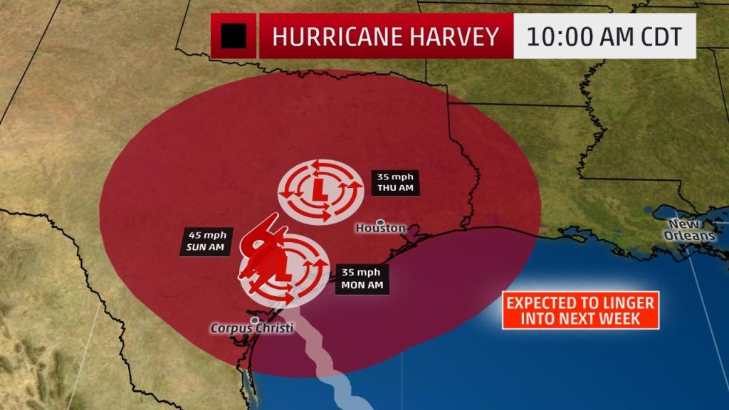
8-26-17 1PM UPDATE: HARVEY BECOMES A TROPICAL STORM INLAND OVER TEXAS… EXTREMELY SERIOUS FLOODING EVENT UNFOLDING FOR TEXAS…
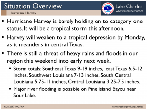
Note: As I have stated the forecast no longer brings Harvey towards Louisiana but SW and central Louisiana can still get 5-10 inches or more rain from this throughout next week from outside feeder bands of Harvey. Flooding in portions of Louisiana still not out of the question.
DISCUSSION AND 48-HOUR OUTLOOK
——————————
At 100 PM CDT (1800 UTC), the center of Tropical Storm Harvey was located by National Weather Service Doppler radar near latitude 29.1 North, longitude 97.6 West. Harvey is moving slowly toward the
north-northwest near 2 mph (4 km/h), and little motion is anticipated during the next several days.
Maximum sustained winds have decreased to near 70 mph (110 km/h) with higher gusts. Additional weakening is forecast during the next 48 hours.
Tropical-storm-force winds extend outward up to 140 miles (220 km).
The estimated minimum central pressure is 987 mb (29.15 inches).
HAZARDS AFFECTING LAND
———————-
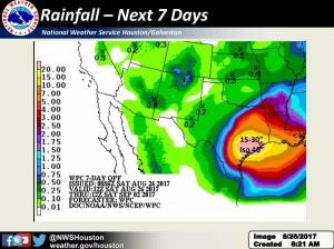
RAINFALL: Harvey is expected to produce total rain accumulations of 15 to 30 inches and isolated maximum amounts of 40 inches over the middle and upper Texas coast through Thursday. During the same
time period Harvey is expected to produce total rain accumulations of 5 to 15 inches in far south Texas, the Texas Hill Country
and southwest and central Louisiana. Rainfall of this magnitude will cause catastrophic and life-threatening flooding. A list of rainfall observations compiled by the NOAA Weather Prediction Center can be found at: www.wpc.ncep.noaa.gov/discussions/nfdscc1.html
STORM SURGE: The combination of a dangerous storm surge and the tide will cause normally dry areas near the coast to be flooded by rising waters moving inland from the shoreline. The water is expected to reach the following heights above ground if the peak
surge occurs at the time of high tide…
Port Aransas to Sargent…4 to 7 ft
Sargent to High Island including Galveston Bay…2 to 4 ft
High Island to Morgan City…1 to 3 ft
The deepest water will occur along the immediate coast near the area of onshore winds, where the surge will be accompanied by large and destructive waves. Surge-related flooding depends on the relative timing of the surge and the tidal cycle, and can vary greatly over short distances. For information specific to your area, please see products issued by your local National Weather Service forecast office.
WIND: Tropical storm conditions are occurring in portions of the tropical storm warning area, and are likely to persist along
portions of the coast through at least Sunday.
SURF: Swells generated by Harvey are affecting the Texas, Louisiana, and northeast Mexico coasts. These swells are likely to
cause life-threatening surf and rip current conditions. Please consult products from your local weather office.
TORNADOES: Tornadoes are possible today and tonight near the middle and upper Texas coast into far southwest Louisiana.
12:45 p.m. Aug. 26
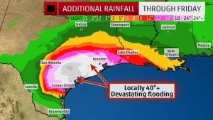
Potential rainfall levels per The Weather Channel:
12:37 p.m. Aug. 26
Tornado warning for NE Orange County and SE Jasper County until 1:00 p.m.
12:12 p.m. Aug. 26 – UPDATE FROM CITY OF PORT ARTHUR
August 26, 2017 11:58 AM
Port Arthur Emergency Management personnel are continuing to monitor weather conditions in coordination with local and state partners.
At this time the City of Port Arthur has stopped sandbag operations due to lightning and poor weather conditions.
Highway 87 into Sabine Pass is still open at this time, but public safety personnel are continuously monitoring road conditions, and will close the road when necessary.
Stay safe, and stay off the roads if you can. Remember standing water on roadways is very dangerous. Avoid underpasses with standing water and low lying areas. If you are out and come across standing water TURN AROUND, DON’T DROWN.
12:03 p.m. Aug. 26
Posted from Weather Forecast Office in Lake Charles at 11:00 a.m.
THE NATIONAL WEATHER SERVICE IN LAKE CHARLES HAS ISSUED A
* FLASH FLOOD WARNING FOR JEFFERSON COUNTY IN SOUTHEASTERN TEXAS SOUTHWESTERN NEWTON COUNTY IN SOUTHEASTERN TEXAS HARDIN COUNTY IN SOUTHEASTERN TEXAS ORANGE COUNTY IN SOUTHEASTERN TEXAS SOUTHEASTERN JASPER COUNTY IN SOUTHEASTERN TEXAS
* UNTIL 545 PM CDT SATURDAY
* AT 1144 AM CDT, DOPPLER RADAR INDICATED HEAVY RAIN ACROSS THE
WARNED AREA. UP TO TWO INCHES OF RAIN HAVE ALREADY FALLEN OVER
PORTIONS OF JEFFERSON AND ORANGE COUTNIES. FLASH FLOODING IS
EXPECTED TO DEVELOP THIS AFTERNOON AS RAINFALL RATES CONTIUE TO
INCREASE.
* SOME LOCATIONS THAT WILL EXPERIENCE FLOODING INCLUDE BEAUMONT, PORT ARTHUR, ORANGE, NEDERLAND, GROVES, PORT NECHES,
LUMBERTON, VIDOR, BRIDGE CITY, SILSBEE, WEST ORANGE, KOUNTZE, SOUR
LAKE, NOME, EVADALE, CENTRAL GARDENS, SABINE PASS, HAMSHIRE,
WILDWOOD AND MAURICEVILLE.
ADDITIONAL RAINFALL AMOUNTS OF TWO TO SIX INCHES WITH LOCALLY HIGHER
AMOUNTS ARE POSSIBLE IN THE WARNED AREA THIS AFTERNOON.
PRECAUTIONARY/PREPAREDNESS ACTIONS
A FLASH FLOOD WARNING MEANS THAT FLOODING IS IMMINENT OR OCCURRING.
IF YOU ARE IN THE WARNED AREA MOVE TO HIGHER GROUND IMMEDIATELY.
RESIDENTS LIVING ALONG STREAMS AND CREEKS SHOULD TAKE IMMEDIATE
PRECAUTIONS TO PROTECT LIFE AND PROPERTY.
Issuing Office: Lake Charles
Source: National Weather Service
Issued: Sat, Aug 26, 11:48 AM CDT
11:49 a.m. Aug 26
Emergency Alert issued. Flash flood warning this area until 5:45 p.m. CDT. Avoid Flood Areas.
10:44 a.m. Aug. 26
The hurricane is over Victoria now, and a wave of bad weather is pushing past Houston and headed our way.
At 8:31 a.m. on Aug. 26
There is a tornado watch in effect until 1 p.m. and there are flood advisories for coastal areas. From the National Weather Service:
Coastal flood advisory remains in effect until 10 am CDT Sunday... * coastal flooding... tides will run 1 to 3 feet above normal. * Timing... flooding at times of high tide. * Impacts... flooding of some roadways near Sabine Pass, Holly Beach, Hackberry, Cameron, Grand Chenier, Delcambre, and cypermort point can be expected. Precautionary/preparedness actions... A coastal flood advisory indicates that onshore winds and tides will combine to generate flooding of low areas along the shore.
At 7:35 a.m. Aug. 26
HEB will close at 9 pm tonight.
HOUSTON, TEXAS – To ensure the safety of H-E-B customers and Partners (employees) and in accordance with H-E-B’s existing inclement weather protocol, H-E-B stores located throughout the area will close early tonight, Sat., Aug. 25, at 9 PM.
To stay current with store closings and re-openings throughout the path of the storm, visit heb.com/disaster or follow us on Facebook at HEB Emergency Preparedness and on Twitter @HEB and @HEBPrepared.
The safety of our employees and customers are H-E-B’s top priority. Updates will be distributed regularly.
H-E-B is also committed to delivering gas to H-E-B Fuel Stations throughout Houston and is diligently working to safely continue delivery to all available H-E-B Fuel Stations. Our Disaster Relief Units with Mobile Kitchens and Pharmacy are prepped and ready to head to areas affected when the storm dissipates.
At 5:16 PM Aug. 25
Port Neches Mayor Glenn Johnson has just signed a declaration of disaster for that town. The declaration will last for 7 days. It says, in part:
WHEREAS, the City of Port Neches on August 25, 2017 is facing the imminent threat of suffering widespread or severe damage, injury,or loss of life or property resulting from the Hurricane Harvey storm system; and,
WHEREAS, the Mayor of the City of Port Neches has determined that extraordinary measures must be taken to alleviate the suffering of people and to protect or rehabilitate property.
at 5 p.m. Aug. 25
Tornado Watch 465 remains in effect until 200 am CDT for the following locations
3:40 p.m.
Brian McDougal, Port Arthur city manager, said the state department of emergency management and the National Weather Service told him Hurricane Harvey will currently be a rainmaker for the area and they’re watching the storm if it bounces back into the Gulf of Mexico.
In addition, Phil Kelley, the Drainage District 7 manager said all pumping stations are working and they will be manned around the clock beginning Sunday. This will continue until the rain stops.
He also said the levee has been successfully temporarily fixed.
At 3:34 p.m. on Friday Aug 25
Sandbags will be available AGAIN in Port Arthur at the Civic Center Friday at 4 p.m. through 8 p.m.
On Saturday, Aug. 26, sandbags will be available 8 a.m. to noon.
From the BUREAU OF SAFETY AND ENVIRONMENTAL ENFORCEMENT
At 1:45 p.m.
NEW ORLEANS — Offshore oil and gas operators in the Gulf of Mexico are evacuating platforms and rigs in preparation for Hurricane Harvey. The Bureau of Safety and Environmental Enforcement (BSEE) Hurricane Response Team is activated and monitoring the operators’ activities. The team will continue to work with offshore operators and other state and federal agencies until operations return to normal and the storm is no longer a threat to Gulf of Mexico oil and gas activities.
Based on data from offshore operator reports submitted as of 11:30 CDT today, personnel have been evacuated from a total of 86 production platforms, 11.67 percent of the 737 manned platforms in the Gulf of Mexico. Production platforms are the structures located offshore from which oil and natural gas are produced. Unlike drilling rigs, which typically move from location to location, production facilities remain in the same location throughout a project’s duration.
Personnel have been evacuated from four rigs (non-dynamically positioned (DP) rig), equivalent to 40 percent of the 10 rigs of this type currently operating in the Gulf. Rigs can include several types of offshore drilling facilities including jackup rigs, platform rigs, all submersibles and moored semisubmersibles.
One DP rigs have moved off location out of the storm’s path as a precaution. This number represents 4.7 percent of the 21 DP rigs currently operating in the Gulf. DP rigs maintain their location while conducting well operations by using thrusters and propellers, the rigs are not moored to the seafloor; therefore, they can move off location in a relatively short time-frame. Personnel remain on-board and return to the location once the storm has passed.
As part of the evacuation process, personnel activate the applicable shut-in procedure, which can frequently be accomplished from a remote location. This involves closing the sub-surface safety valves located below the surface of the ocean floor to prevent the release of oil or gas. During previous hurricane seasons, the shut-in valves functioned 100 percent of the time, efficiently shutting in production from wells on the Outer Continental Shelf and protecting the marine and coastal environments. Shutting-in oil and gas production is a standard procedure conducted by industry for safety and environmental reasons.
From operator reports, it is estimated that approximately 21.55 percent of the current oil production of 1,750,000 barrels of oil per day in the Gulf of Mexico has been shut-in, which equates to 377,117 barrels of oil per day. It is also estimated that approximately 23.24 percent of the natural gas production of 3,220 million cubic feet per day, or 748 million cubic feet per day in the Gulf of Mexico has been shut-in. The production percentages are calculated using information submitted by offshore operators in daily reports. Shut-in production information included in these reports is based on the amount of oil and gas the operator expected to produce that day. The shut-in production figures therefore are estimates, which BSEE compares to historical production reports to ensure the estimates follow a logical pattern.
After the storm has passed, facilities will be inspected. Once all standard checks have been completed, production from undamaged facilities will be brought back on line immediately. Facilities sustaining damage may take longer to bring back on line. BSEE will continue to update the evacuation and shut-in statistics at 1:00 p.m. CDT each day as appropriate.
At 1:40 p.m. Aug. 25
Governor Abbott Requests Presidential Disaster Declaration In Anticipation Of Hurricane Harvey
AUSTIN – Governor Greg Abbott today sent a letter to President Donald J. Trump requesting a Presidential Disaster Declaration as Hurricane Harvey is set to make landfall. The state is expected to see life-threatening and record-setting flooding from rain and storm surge in areas hardest hit by Harvey.
If granted by the president, this request will provide Individual Assistance, Public Assistance and Hazard Mitigation to Texas counties in the affected areas. This request also allows the Governor to request assistance for additional counties after damage assessments are made. The request will provide Texas with the necessary resources to respond to the severity and magnitude of Hurricane Harvey in order to help save lives and to protect property, public health and safety, or to lessen or avert the threat of a disaster.
“Granting this request will provide Texans the additional resources needed to protect themselves, their property and rebuild their lives if necessary after Hurricane Harvey,” said Governor Abbott. “I spoke with President Trump yesterday and am confident that he will move quickly to grant this request and provide the people of Texas with everything they need to recover from this storm. I want to continue to encourage Texans to take this threat seriously, heed warnings from local officials, and do all they can to prepare as the state of Texas works to ensure we are in the best position to respond to urgent needs following this storm.”
At 12:28 p.m. Aug. 25
Port Arthur Independent School District bus routes will run on a one-hour delay due to inclement weather on Monday, August 28th. Please refer to the times posted and adjust accordingly. Our campuses will be open at the regularly scheduled time in the event parents need to drop their children to school. Breakfast and lunch will be served at the regular scheduled times, but all students will eat, regardless of the time they arrive to school. The safety and security of our students and staff are of upmost concern. Please follow the District’s social media pages, website and download the mobile app for up-to-date District information and watch the local news for more updates on Tropical Storm Harvey.
At of 12:26 p.m. Friday, Aug. 25
The latest as of 12:17 pm Friday, Aug. 25
Lamar U and Lamar College Port Arthur are cancelling classes Monday and Tuesday. All events for Saturday and Sunday are also cancelled.
Check-in will be available for students wishing to move into residence halls, however students are urged to check local weather and highway conditions. Normal business operations will be suspended and all faculty and non-essential staff should not report to work on Monday.
Lamar staff and contracted recovery teams are on standby to prepare the campus for normal operations as soon as the system has passed.
Monitoring of the situation is ongoing. Notifications and updates will be communicated through the university’s website, social media networks and Connect-ED.
The latest as of 8:36 a.m. Friday, Aug. 25:
At 8AM on Friday, August 25th, the City of Nederland will have SANDBAGS available in anticipation of Hurricane Harvey’s rainfall. Nederland residents can pick up free sandbags at the Nederland Service Center (515 Hardy Avenue); residency will be confirmed with either a driver’s license or a utility bill. Nederland residents will be provided up to 8 sandbags per vehicle. Residents must bring a shovel to fill their sandbags. If you have any questions, please contact the City Manager’s Office at (409) 723-1503.
The latest as of 8:33 a.m. Friday, Aug. 25:
Governor Abbott Urges Gulf Coast Residents To Heed Warnings From Local Officials
AUSTIN – As Hurricane Harvey approaches, Governor Greg Abbott today asked that all Texans heed the warnings of local officials, strongly consider all voluntary evacuation orders, and strictly comply with all mandatory evacuation orders. Communities along the Gulf Coast, specifically the Corpus Christi and the Houston areas, are at greatest risk of being impacted by this severe weather.
“My priority, as we prepare for Hurricane Harvey, is the safety of those on and near the Gulf Coast,” said Governor Abbott. “That is why I am strongly urging all Texans in Harvey’s path to heed warnings and evacuation orders from local officials before this storm makes landfall. My office is coordinating local, state and federal resources to prepare for and respond decisively to this storm—Texans must also take action and treat this storm seriously.”
The Governor also asks Texans to review important safety information and the following instructions:
- Board up doors and windows with plywood or install storm shutters. Keep in mind that winds are stronger at higher elevations, such as high-rise apartments or condos.
- Bring in outdoor objects that could become deadly missiles, such as patio furniture, hanging plants, trash cans, gardening tools and barbecues.
- If your home is vulnerable to rising water, move furniture and valuables to a higher level.
- Before evacuating, cut off your electricity and turn off the gas. Downed electrical wires and broken gas pipes can be deadly and cause serious property damage. Make a final walk-through inspection of your home before leaving.
- Moor boats securely or move them to designated safe areas well in advance of hurricanes. Do not try to tow a trailer or boat in high winds.
- Assemble a family emergency supplies kit and have it ready to go at a moment’s notice.
- When officials recommend or order an evacuation, leave. Do not try to ride out a hurricane in a high-risk area. Seek shelter inland with family or friends, at a hotel or designated shelter. Notify relatives and friends of your plans, and confirm hotel reservations.
- Find out where shelters are located along your route in case clogged roads prevent you from reaching your destination.
- Look at the evacuation maps for your area ahead of time.
The latest as of 8: 20 a.m. Friday, Aug. 25:
The National Weather Service has issued a coastal flood advisory:
... Coastal flood advisory remains in effect from this morning to 10 am CDT Sunday... * coastal flooding... tides will run 1 to 3 feet above normal. * Timing... flooding at times of high tide. * Impacts... flooding of some roadways near Sabine Pass, Holly Beach, Hackberry, Cameron, Grand Chenier, Delcambre, and cypermort point can be expected. Precautionary/preparedness actions... A coastal flood advisory indicates that onshore winds and tides will combine to generate flooding of low areas along the shore.


