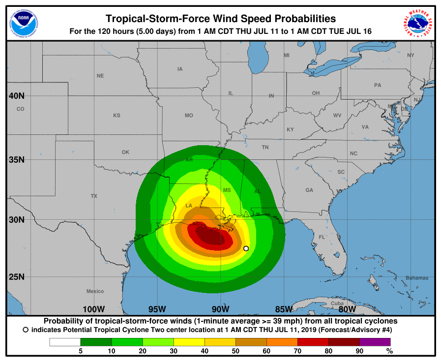
Hurricane expected to make landfall Saturday morning between Lafayette & Morgan City in La.
Published 7:22 am Thursday, July 11, 2019
Jefferson County was not under a Hurricane or Storm Surge Watch as of 7 a.m. Thursday but is under a Tropical Wind Threat.
As of early this morning, weather experts predicted the storm churning through the Gulf of Mexico would become a Tropical Depression later today (Thursday).
The National Hurricane Center is currently predicting that a low-category hurricane will eventually form and make landfall Saturday morning in Louisiana, somewhere between Lafayette and Morgan City.
Trending
A Storm Surge Watch is in effect for the mouth of the Pearl River to Intracoastal City in Louisiana.
A Hurricane Watch is in effect for the mouth of the Mississippi River to Cameron.
A Tropical Storm Watch is in effect for the mouth of the Mississippi River northward to the Mouth of the Pearl River.
Reports from a NOAA Hurricane Hunter aircraft indicate maximum sustained winds are near 35 mph with higher gusts. Strengthening is forecast during the next couple of days, and the disturbance is forecast to become a tropical depression or tropical storm later today, and could become a hurricane by late Friday.
The convective activity associated with the broad area of low pressure is still spread out, and the center of circulation is not well defined.
The intensity models are not as aggressive as they were in previous runs, according to the Hurricane Center, but still bring the disturbance to hurricane status in about 48 hours or so.
Trending
A dangerous storm surge is possible in portions of southern and southeastern Louisiana where a Storm Surge Watch is in effect. Additional storm surge watches may be needed later today.
A Hurricane Watch is in effect for much of the Louisiana coast and additional tropical storm or hurricane watches and warnings could be required.
The slow movement of this system will result in a long duration heavy rainfall threat along the central Gulf Coast and inland through the lower Mississippi Valley through the weekend and potentially into early next week.


