National Weather Service outlines timeline, severe storm impacts this weekend
Published 6:20 am Friday, December 8, 2023
|
Getting your Trinity Audio player ready...
|
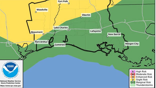
A strong cold front is expected to move across Southeast Texas late Saturday afternoon and Saturday night.
According to the National Weather Service, this front will bring a risk of severe storms, then marine hazards due to strong and gusty north winds.
The timing of the Severe Storms is starting late Saturday afternoon, after 3 p.m., into the evening and night, and ending by 3 a.m. Sunday.
Damaging straight line wind gusts and large hail are the main hazards.
Strong north winds behind the front on Saturday night into Sunday are expected to produce frequent gusts over gale force and around 40 knots with building seas up to 12 feet for the outer waters.
A Gale Watch has already been issued for Southeast Texas and Southwest Louisiana coastal waters and likely will be extended to the east later today.
Also, the strong offshore winds will push water out of coastal lakes and bays and away from the coast producing low water conditions during the low tide cycle on Sunday morning.


