Update: Damaging winds forecast with thunderstorms to hit Orange County Saturday
Published 6:20 pm Saturday, August 3, 2024

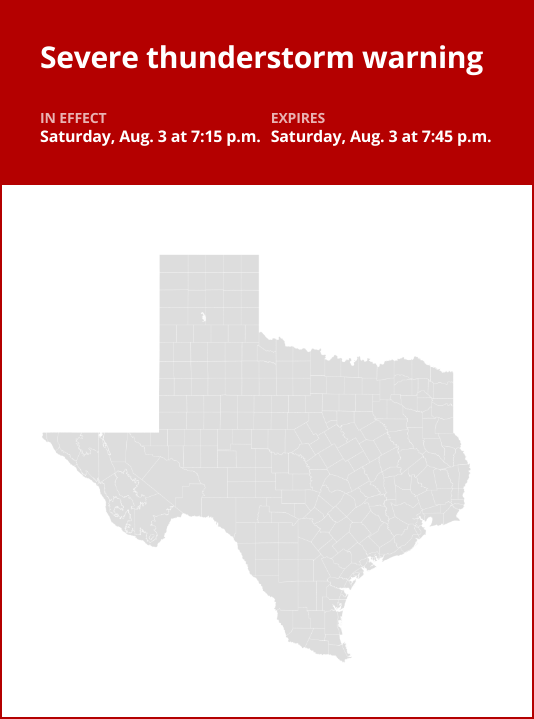
The National Weather Service issued an updated severe thunderstorm warning at 7:15 p.m. on Saturday in effect until 7:45 p.m.
Residents should be prepared for wind gusts of up to 60 mph.
“At 7:14 p.m., a severe thunderstorm was located over Forest Heights, or near Deweyville, moving south at 15 mph,” states the NWS. “Expect damage to roofs, siding, and trees.”
Locations impacted by the warning include Orange, West Orange, Vinton, Forest Heights, Toomey and Pinehurst.
The NWS states, “For your protection move to an interior room on the lowest floor of a building. Torrential rainfall is occurring with this storm, and may lead to flash flooding. Do not drive your vehicle through flooded roadways.”
Lightning on the horizon: Expert safety measures for thunderstorms
Lightning strikes the United States approximately 25 million times each year, with the bulk of these electrical discharges occurring during the summer months. Tragically, lightning claims the lives of about 20 individuals annually, as reported by the NWS. The risk of lightning-related incidents escalates as thunderstorms draw near, reaching its peak when the storm directly looms overhead. However, it gradually recedes as the tempest moves away.
To protect yourself during a thunderstorm, take these recommendations into consideration:
Lightning safety plan:
- When venturing outdoors, it’s crucial to have a lightning safety plan in place.
- Monitor the sky for threatening signs and listen for the sound of thunder. If thunder is audible, it’s an indication that lightning is nearby.
- Seek shelter promptly in a safe location, preferably indoors.
Indoors safety measures:
- Once you’re indoors, avoid using corded phones, electrical devices, plumbing fixtures, and stay away from windows and doors.
- Lightning can follow conductive pathways, and these precautions reduce the risk of electrical surges.
Wait for the all-clear:
- After the last lightning strike or thunderclap, wait at least 30 minutes before resuming outdoor activities.
- It’s important to remember that lightning can strike even when a storm seems to have passed, so exercise caution.
When indoor shelter isn’t available:
If you find yourself outdoors with no access to indoor shelter during a thunderstorm, take these steps to maximize your safety:
- Avoid open fields, hilltops, or ridge crests, as they expose you to greater lightning risk.
- Steer clear of tall, isolated trees and other prominent objects. In wooded areas, stay close to lower stands of trees.
- If you’re with a group, ensure individuals are spread out to prevent lightning current from transferring between people.
- Camping in an open setting during a thunderstorm is strongly discouraged. If no alternative exists, set up camp in a valley, ravine, or other low-lying areas. Remember that a tent offers no protection against lightning.
- Do not approach water bodies, wet objects, or metal items. While water and metal don’t attract lightning, they conduct electricity effectively and can pose significant risks.
In summary, when facing the threat of lightning, vigilance and preparedness are your best allies. By following these guidelines, you can significantly reduce the chances of lightning-related accidents and prioritize your safety.
Rainy roadways ahead: Essential safety tips for heavy rain
When heavy rain sets in, the risk of flooding and hazardous driving conditions rises. Whether it’s prolonged rainfall or rapid runoff, being prepared is essential. Here are some valuable safety tips from the NWS to ensure you stay safe in heavy rain:
Beware of rapid water flow:
During heavy rain, avoid parking or walking near culverts or drainage ditches, where swift-moving water can pose a serious risk.
Maintain safe driving distances:
Use the two-second rule to maintain a safe distance from the car in front of you and allow an extra two seconds in heavy rain.
Reduce speed and drive cautiously:
On wet roads, reducing your speed is crucial. Ease off the gas pedal gradually and avoid abrupt braking to prevent skidding.
Choose your lane wisely:
Stick to the middle lanes on multi-lane roads to minimize the risk of hydroplaning, as water tends to accumulate in outer lanes.
Visibility matters:
Enhance your visibility in heavy rain by activating your headlights. Be particularly vigilant for vehicles in blind spots, as rain-smeared windows can obscure them.
Watch out for slippery roads:
The first half-hour of rain is when roads are slickest due to a mix of rain, grime, and oil. Exercise heightened caution during this period.
Keep a safe distance from large vehicles:
Don’t follow large trucks or buses too closely. The spray created by their large tires reduces your vision. Take care when passing them as well; if you must pass, do so quickly and safely.
Mind your windshield wipers:
Heavy rain can overload the wiper blades. When visibility is so limited that the edges of the road or other vehicles cannot be seen at a safe distance, it is time to pull over and wait for the rain to ease up. It is best to stop at rest areas or other protected areas.
When stopping by the roadside is your only option, position your vehicle as far off the road as possible, ideally beyond guardrails. Keep your headlights on and activate emergency flashers to alert other drivers of your position.
By following these safety measures, you can significantly reduce risks and ensure your well-being when heavy rain pours down. Stay informed about weather conditions and heed advice from local authorities to make your journey safe and sound.
Source: The National Weather Service