Update on major hurricane project highlights need for greater Port Arthur protection
Published 7:07 pm Tuesday, October 10, 2023

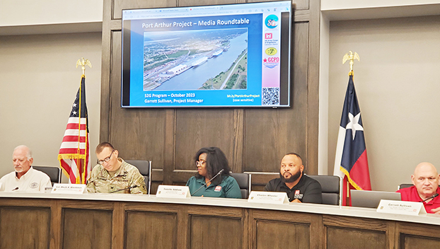
- Jefferson County Drainage District 7 General Manger Phil Kelley, left, U.S. Army Corps of Engineers Col. Rhett Blackmon, Mega Projects Chief Toni Addison, Program Manager for Port Arthur and Freeport Projects Charles Wheeler and Project Manager for the Port Arthur Project Garrett Sullivan lead a discussion on the project to enhance hurricane protection in the city. (Mary Meaux/The News)
|
Getting your Trinity Audio player ready...
|
Port Arthur’s importance to the nation’s economic wellbeing is evident with the multi-million dollar project to enhance hurricane protection.
The $863 million Port Arthur Project is part of the Sabine Pass to Galveston Bay (S2G) Mega Project, which includes the raising and construction of levees and pump station work.
“Petrochemical plants here in Port Arthur make up 10 percent of the nation’s daily production of oil. It’s a critical part of not only the Port Arthur economic viability, but it’s a critical part of the nation’s energy production,” said Garrett Sullivan, project manager for the Port Arthur Project. “It’s important for the community to not only protect the residents because a lot of the residents work and support defensive company facilities, but it’s also important to protect the plants because it impacts the entire United States.”
A contract for a portion of the project to enhance hurricane protection in Port Arthur was recently awarded with construction set to start early next year.
Officials with the U.S. Army Corps of Engineers, project managers and representatives of Jefferson County Drainage District 7 gathered at the recently constructed DD7 offices Tuesday to provide an update on the major project.
Col. Rhett Blackmon, commander of the Galveston District U.S. Army Corps of Engineers, said when completed, the Port Arthur Project will protect future generations of Jefferson County residents from hurricane related storm surge, as well as reduce erosion of the bay and Gulf shorelines, which endangers the local ecology.
The Port Arthur Project is part of a bigger effort by the Corps of Engineers along the upper Texas coast to help protect the Freeport, Port Arthur and Orange County communities, Blackmon said.
Port Arthur’s levees were first built between 1966 and 1983. Port Arthur has experienced 54 hurricanes in the past 93 years, 10 of those since the 1980s, Blackmon said.
Storm intensity has increased through the years, and 2008’s Hurricane Ike storm surge of 14 to 17 feet almost topped the floodgates at FM 365/Rodair Gully.
Thus comes the need to make the levees taller.

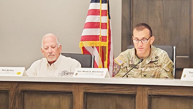
Jefferson County Drainage District 7 General Manger Phil Kelley, left, and U.S. Army Corps of Engineers Col. Rhett Blackmon during Tuesday’s media roundtable discussion on the $863M Port Arthur Project. (Mary Meaux/The News)
Project summary
According to information from the Corps of engineers, the Port Arthur Project, which officials believe will protect the area for the next 50 years, includes:
- Raising of approximately 13.25 miles of existing earthen levees
- The addition or reconstruction of approximately 5 miles of floodwall and associated tie-in structures
- The construction of approximately 2.2 miles of new earthen levee in the Port Neches area
- The construction of fronting protection at 10 pumping stations along the existing levee system
- The replacement of 21 road/railroad closure structures
- Erosion projection improvements at multiple locations
The timeline for the project started with a feasibility study in 2017, funding from Congress in 2018, the first contract award in 2019 and the beginning of construction in 2020. The project completion date is 2031.
What’s next?
Contract 4, which is the largest contract for the Port Arthur program, includes new flood wall replacement along residential communities that front the Sabine Neches waterway, some earthen levee improvements at the far ends and fronting protection for three pumping stations.
The contract is ready to go out to bid soon, Sullivan said.
The contract is expected to be awarded in August 2024 and construction to begin Spring 2025. Construction completion is planned for late fall 2028.
For more information on the Port Arthur Project and the S2G Mega Project, go to swg.usace.army.mil/S2G/PortArthur.
Orange County Project
According to the Corps of Engineers, the Orange County Project provides coastal storm surge protection and flood damage reduction for the residents and businesses within the coastal hazard zones in Orange County.
The main features authorized for the Orange County Project include:
- Approximately 20 miles of new earthen levees
- Approximately 3 miles of new concrete floodwalls
- Approximately 150-200 gravity drainage structures and 14-16 new pump stations, providing interior drainage for areas behind the levee/floodwall
- Approximately 40 closure structures located at road and railroad crossings
- Two navigable sector gates, with adjacent vertical lift gates, at Adams and Cow Bayous
- Restoration of coastal marsh and preservation of wetlands, as mitigation for the ecosystem values lost due to the construction and operation of the project


